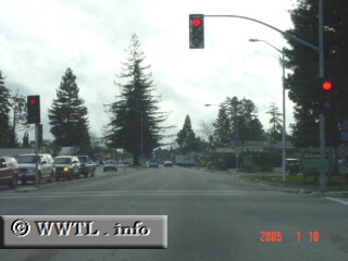
(Southbound Ocean Street; Santa Cruz, California)
--Photo taken by Carlos Rogers c. 2000s ✔
Viatype:S4-D
Map Location: 36.9852, -122.02351![]()
Southbound State Route 100 as it meets its first traffic-light. Some distance ahead,
State Route 100 turns west off of Ocean Street
Next
photo>>>
<<<Previous
photo
Distance Chart for
California 100
California 100
| Junction California 1 | |||||
| 2.1 | Junction California 17 | ||||
| 1.9 | 0.2 | Santa Cruz, California | |||
Approximate distance in km
(1 km = 0.621 miles)
(1 km = 0.621 miles)