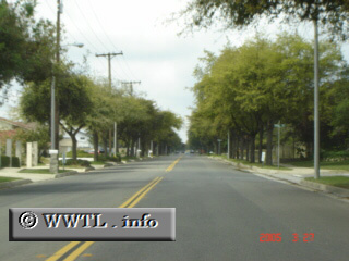
(Westbound 19th Street.; Upland, California)
--Photo taken by Carlos Rogers c. 2000s ✔
Viatype:S4-D
Along Upland's 19th Street, signage for State Route 30 was not existent; in fact, the
only way to know its presence was by an awkward mileage-sign at its
intersection with Euclid Avenue (State Route 83). Not far from this junction, a historical mileage-sign guided (and still guides) motorists onto westbound 19th Street, while indicating mileage to Los
Angeles. Coincidentally, 19th Street does not connect to Los Angeles, and
only constituted a small leg of State Route 30.
Next
photo>>>
<<<Previous
photo
Distance Chart for
Former California 30
Former California 30
| San Antonio Heights, California | |||
| 17 | San Bernardino, California | ||
Approximate distance in km
(1 km = 0.621 miles)
(1 km = 0.621 miles)