(Webster Tube; Oakland, California)
--Photo taken by Carlos Rogers c. 2000s ✔
Viatype:F4-D
Map Location: 37.79397, -122.27494![]()
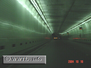
The westbound descent into the Webster Tube begins.
Next
photo>>>
<<<Previous
photo
Distance Chart for
California 260
California 260
| Alameda, California | |||||
| 0.4 | Junction California 61 | ||||
| 3.6 | 4.0 | Oakland, California | |||
Approximate distance in km
(1 km = 0.621 miles)
(1 km = 0.621 miles)