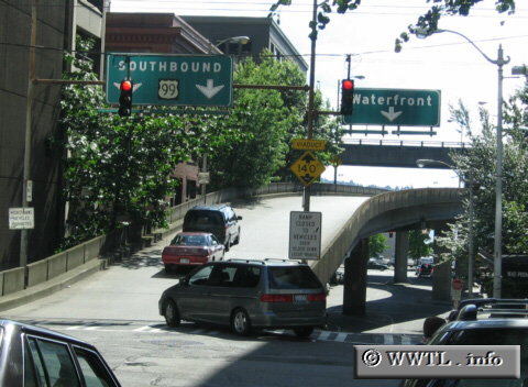
(Westbound Columbia Street; Seattle, Washington State)
--Photo taken by Dan Peri c. 2000s ✔
Viatype:F2-D
Map Location: 47.60315, -122.33507![]()
This traffic light marks the beginning of an extended onramp to the Alaskan Way Viaduct. Note how a Federal Route 99 shield decorates the overhead instead of a Washington State Route 99 counterpart. Pretty neat!
Next
photo>>>
<<<Previous
photo
Distance Chart for
State Route 99
State Route 99
| Des Moines | |||||||||
| 65 | Everett | ||||||||
| 76 | 72 | Federal Way | |||||||
| 72 | 83 | 11 | Seattle | ||||||
| 21 | 83 | 45 | 11 | Tacoma | |||||
Approximate distance in km
(1 km = 0.621 miles)
(1 km = 0.621 miles)