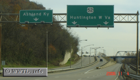
(Eastbound US Federal Route 52 Freeway; Lawrence County, Ohio)
--Photo taken by Carlos Rogers in 2006 ✔
Viatype:F4-D
Map Location: 38.48996, -82.64349![]()
The lefthand exit is for Ashland, a Kentucky bordertown. Its riverfront area boasts a rather conspicious multi-storied residential complex.
Distance Chart for
Federal Route 52
Federal Route 52
| Charleston, South Carolina | |||||||||
| 1590 | Chicago | ||||||||
| 1224 | 366 | Indianapolis, Indiana | |||||||
| 2283 | 793 | 1159 | Minneapolis | ||||||
| 3335 | 1746 | 2111 | 962 | Portal, North Dakota | |||||
Approximate distance in km
(1 km = 0.621 miles)
(1 km = 0.621 miles)