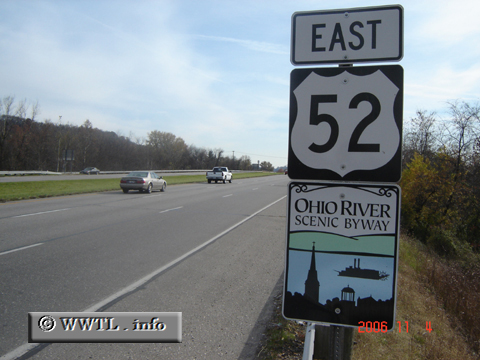
(Eastbound US Federal Route 52 Freeway; Lawrence County, Ohio)
--Photo taken by Carlos Rogers in 2006 ✔
Viatype:S4-D
Representin' the Valley, yo. Ohio Valley, that is.
Next
photo>>>
<<<Previous
photo
![]()
![]()
![]()
![]()
Distance Chart for
Federal Route 52
Federal Route 52
| Charleston, South Carolina | |||||||||
| 1590 | Chicago | ||||||||
| 1224 | 366 | Indianapolis, Indiana | |||||||
| 2283 | 793 | 1159 | Minneapolis | ||||||
| 3335 | 1746 | 2111 | 962 | Portal, North Dakota | |||||
Approximate distance in km
(1 km = 0.621 miles)
(1 km = 0.621 miles)