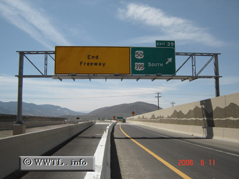
(Southbound US Federal Route 395 Freeway; Carson City, Nevada)
--Photo taken by Carlos Rogers in 2006 ✔
Viatype:F4-D
Map Location: 39.18011, -119.74359![]()
As of June 2006, the Carson City Freeway ends at junction Federal Route 50 (William Street). From there, Federal Route 395 follows westbound US Federal Route 50 into city-centre.
Next
photo>>>
<<<Previous
photo
Distance Chart for
Federal Route 395
Federal Route 395
| Burns, Oregon | |||||||||
| 1294 | Hesperia, California | ||||||||
| 806 | 2100 | Laurier, Washington State | |||||||
| 692 | 820 | 1033 | Reno, Nevada | ||||||
| 431 | 1725 | 375 | 1033 | Yakima, Washington State | |||||
Approximate distance in km
(1 km = 0.621 miles)
(1 km = 0.621 miles)