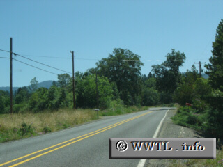
(Eastbound State Route 46; Josephine County, Oregon)
--Photo taken by Carlos Rogers c. 2000s ✔
Viatype:S4-D
Two miles outside of Cave Junction, Oregon State Route 46's path remains a few feet above
the actual elevation. Thus, the shoulder is tilted to a substantial
degree.
Next
photo>>>
<<<Previous
photo
Distance Chart for
Oregon 46
Oregon 46
| Cave Junction, Oregon | |||||
| 18 | Chinquapin Campground | ||||
| 31 | 13 | Oregon Caves Monument | |||
Approximate distance in km
(1 km = 0.621 miles)
(1 km = 0.621 miles)