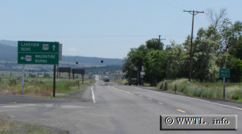
(End Southbound State Route 31; Valley Falls, Oregon)
--Photo taken by Carlos Rogers in 2005 ✔
Viatype:S2-U
Map Location: 42.48594, -120.28215
Junction Federal Route 395. Reno lies 270 miles ahead.<<<Previous
photo
Junction Federal Route 395. Reno lies 270 miles ahead.
Distance Chart for
Oregon 31
Oregon 31
| La Piñe, Oregon | |||||
| 79 | Silver Lake, Oregon | ||||
| 197 | 118 | Valley Falls, Oregon | |||
Approximate distance in km
(1 km = 0.621 miles)
(1 km = 0.621 miles)