| | 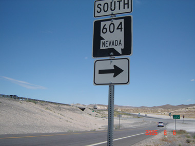
(Southbound State Route 604; Clark County, Nevada)
--Photo taken by Carlos Rogers in 2005 ✔
Viatype:S4-D
Map Location: 36.30919, -114.95402
Nevada State Route 604 runs parallel to Interstate 15 and is the hidden designation for Las Vegas
Boulevard (a.k.a., the Las Vegas Strip). Shield-posting for the route is
extremely rare. However, an example of this can be found from Interstate 15 north's
connector ramp to southbound Nevada State Route 604.
Next
photo>>>
| |