United States
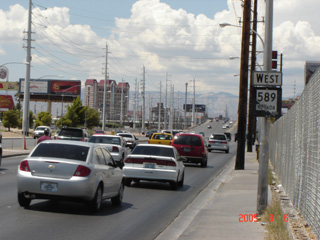
(Westbound Sahara Avenue; Las Vegas, Nevada)
--Photo taken by Carlos Rogers in 2005
✔
Viatype:
S4-D
Nevada State Route 589 overlaid Sahara Avenue, a multi-laned boulevard named in honour of the Sahara Hotel and Casino.
Next photo>>>
Share with:
Share information about this road!
Distance Chart for
Former Nevada 589
Junction Las Vegas Strip
8.2
Junction Nevada 595
8.4
17
Winterwood, Sunrise Manor
Approximate distance in km
(1 km = 0.621 miles)