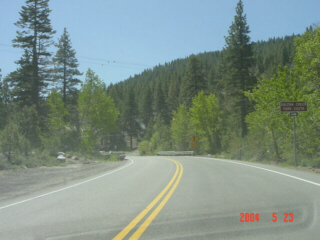
(Westbound State Route 431; Washoe County, Nevada)
--Photo taken by Carlos Rogers c. 2000s ✔
Climbing the hills as Mt. Rose and Lake Tahoe approach.
Distance Chart for
Nevada 431
Nevada 431
| Incline Village, Nevada | |||||
| 14 | Mount Rose | ||||
| 42 | 28 | Virginia Foothills, Nevada | |||
Approximate distance in km
(1 km = 0.621 miles)
(1 km = 0.621 miles)