| | 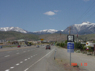
(Westbound State Route 431; Washoe County, Nevada)
--Photo taken by Carlos Rogers c. 2000s ✔
Viatype:S4-D
Map Location: 39.39422, -119.76366
Highway 431 provides Reno
residents with a path to higher elevation and skiing resorts. Mt. Rose,
the mountain on the far right, is likely a favourite among many local skiers and
snowboarders.
Next
photo>>>
| |