| | 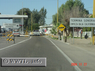
(Westbound Federal Route 2; just east of
Sonora-Baja California border)
--Photo taken by Carlos Rogers in 2021 ✔
Viatype:S4-D
Map Location: 32.4917, -114.8084
English |
español
As of November 2004, this booth
charges an eleven-peso toll for leaving Sonora.
Next
photo>>>
<<<Previous
photo
| |