| | 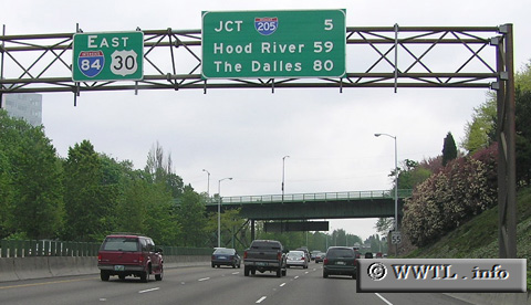
(Eastbound Interstate 84/Federal Route 30; Portland, Oregon)
--Photo taken by Chris Elbert in 2005 ✔
Viatype:F6-D
Map Location: 45.52779, -122.65571
In much of Oregon,
Federal Route 30 duplexes with Interstate 84.
Next
photo>>>
<<<Previous
photo
|
Distance Chart for
USA Interstate 84 | Boise, Idaho | | 559 | | The Dalles, Oregon | | 893 | | 134 | | Portland, Oregon | | 430 | | 984 | | 1117 | | Tremonton, Utah | | 208 | | 759 | | 893 | | 235 | | Twin Falls, Idaho |
Approximate distance in km
(1 km = 0.621 miles) |