| | 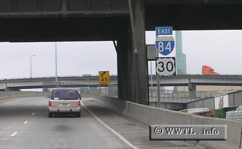
(Eastbound Interstate 84/Federal Route 30 Portland, Oregon)
--Photo taken by Chris Elbert in 2005 ✔
Viatype:F4-D
Map Location: 45.52275, -122.66513
The "western"
Interstate 84 extends from Portland, Oregon to Echo, Utah. In the state of
Oregon, this route hugs the Columbia River for the majority of its path.
Next
photo>>>
|
Distance Chart for
USA Interstate 84 | Boise, Idaho | | 559 | | The Dalles, Oregon | | 893 | | 134 | | Portland, Oregon | | 430 | | 984 | | 1117 | | Tremonton, Utah | | 208 | | 759 | | 893 | | 235 | | Twin Falls, Idaho |
Approximate distance in km
(1 km = 0.621 miles) |