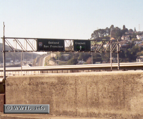
(Westbound Eastshore Freeway; Crockett, California)
--Photo taken by Trevor Carrier c. 2000s ✔
Viatype:F8-D
Map Location: 38.0558, -122.22534
Notice the "straight-arrow" under the Crockett exit. This overhead used to be an offramp-location for Crockett, but was later demolished when a newer span of the Carquinez Bridge was built. To the left of this overhead (not pictured) is the C&H sugar factory.
Distance Chart for
Interstate 80
Interstate 80
| Chicago | |||||||||||
| 1274 | New York City | ||||||||||
| 3080 | 4326 | Reno | |||||||||
| 2248 | 3495 | 835 | Salt Lake City | ||||||||
| 3429 | 4676 | 351 | 1184 | San Francisco | |||||||
Approximate distance in km
(1 km = 0.621 miles)
(1 km = 0.621 miles)