Distance Chart for
Interstate 80
Interstate 80
| Chicago | |||||||||||
| 1274 | New York City | ||||||||||
| 3080 | 4326 | Reno | |||||||||
| 2248 | 3495 | 835 | Salt Lake City | ||||||||
| 3429 | 4676 | 351 | 1184 | San Francisco | |||||||
Approximate distance in km
(1 km = 0.621 miles)
(1 km = 0.621 miles)
| United States |
|
Distance Chart for Interstate 80
Approximate distance in km (1 km = 0.621 miles) |
||||||||||||||||||||||||||||||||||||||||||||||||||||||||||
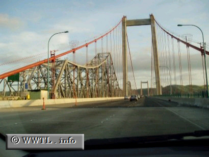
The Carquinez Bridge is actually composed of two separate bridges--the one on the right is the earth-quake retrofitted version, just completed in 2004. The one on the left is the older span, which may sink to the bottom of the bay if a strong enough earthquake hits.
Next
photo>>>
<<<Previous
photo