On approach to her southern
terminus, the route goes through a modified ninety-degree curve through the San
Gabriel Mountains.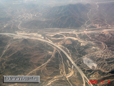
(Southbound Barstow Freeway; San Bernardino County, California)
--Photo taken by Carlos Rogers in 2006 ✔
Viatype:F8-D
Map Location: 34.31143, -117.47477![]()
Next photo>>>
<<<Previous
photo
![]()
![]()
![]()
![]()
Distance Chart for
Interstate 15
Interstate 15
| Helena, Montana | |||||||||||
| 1452 | Las Vegas | ||||||||||
| 517 | 937 | Pocatello, Idaho | |||||||||
| 778 | 677 | 264 | Salt Lake City, Utah | ||||||||
| 1982 | 536 | 1476 | 1216 | San Diego, Calif. | |||||||
Approximate distance in km
(1 km = 0.621 miles)
(1 km = 0.621 miles)