The mighty Mississippi River, pictured above, separates the states of
Tennessee and Missouri.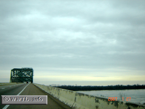
(End of Westbound Interstate 155 and beginning of
Northbound Interstate 155; Tennessee-Missouri line)
--Photo taken by Carlos Rogers in 2007 ✔
Viatype:F4-D
Map Location: 36.11144, -89.61094![]()
Distance Chart for
USA Interstate 155
USA Interstate 155
| Caruthersville, Missouri | |||||
| 59 | Dyersburg, Tennessee | ||||
| 26 | 74 | Hayti, Missouri | |||
Approximate distance in km
(1 km = 0.621 miles)
(1 km = 0.621 miles)