(Northbound State Route 330; Highland, California)
--Photo taken by Erica Burdoin in 2006 ✔
Viatype:F4-D
Map Location: 34.13579, -117.19202
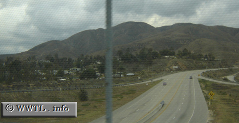
At this location, State Route 330 transitions from being a freeway into a windy mountain road. The San Bernardino Mountains create a rugged, curvaceous path for the route. Most motorists use this route when going to Arrowhead Lake and Big Bear Lake.
At this location, State Route 330 transitions from being a freeway into a windy mountain road. The San Bernardino Mountains create a rugged, curvaceous path for the route. Most motorists use this route when going to Arrowhead Lake and Big Bear Lake.
Next
photo>>>
<<<Previous
photo
Distance Chart for
California 330
California 330
| Highland, California | |||||
| 26 | Running Springs, California | ||||
| 22 | 3.8 | Small Canyon, San Bernardino | |||
Approximate distance in km
(1 km = 0.621 miles)
(1 km = 0.621 miles)