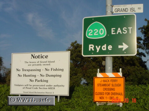
( (Eastbound Grand Island Road; Grand
Island, Sacramento County, California))
--Photo taken by Carlos Rogers c. 2000s ✔
Viatype:S2-U
Map Location: 38.23646, -121.60212![]()
Once the eastbound ferry-ride completes, motorists can continue their journey through Sacramento County. If wishing to loiter, choosing a levee-road as your destination may entail legal intervention.
Next
photo>>>
<<<Previous
photo
Distance Chart for
California 220
California 220
| Junction California 84 | |||||
| 6.4 | Howard Landing, California | ||||
| 4.1 | 11 | Ryde, California | |||
Approximate distance in km
(1 km = 0.621 miles)
(1 km = 0.621 miles)