United States
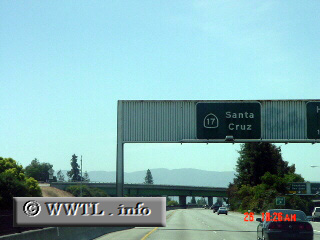
(Southbound State Route 17; San Jose, California)
--Photo taken by Carlos Rogers c. 2000s
✔
Viatype:
F6-D
Map Location:
37.32149, -121.94057
Highway 17 squeezes through the Santa Cruz Mtns. of central California.
Next photo>>>
Share with:
Share information about this road!
Distance Chart for
California 17
Los Gatos, California
17
San Jose, California
52
35
Santa Cruz, California
Approximate distance in km
(1 km = 0.621 miles)