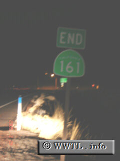
(Westbound State Route 161; Siskiyou County, California)
--Photo taken by Carlos Rogers c. 2000s ✔
Map Location: 41.99991, -121.89045![]()
End westbound State Route 161. Just ahead lies a motorist's next level of
options.
Next
photo>>>
<<<Previous
photo
![]()
![]()
![]()
![]()
Distance Chart for
California 161
California 161
| Ainsworth Corner, Sacramento | |||||
| 33 | Dorris, California | ||||
| 3.4 | 36 | Hatfield, California | |||
Approximate distance in km
(1 km = 0.621 miles)
(1 km = 0.621 miles)