United States
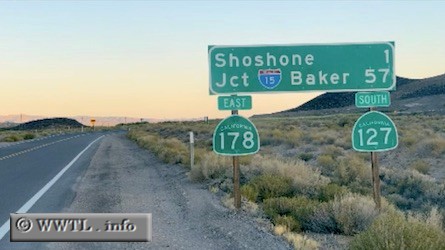
(Southbound State Route 127/Eastbound State Route 178; Inyo County, California)
--Photo taken by Carlos Rogers in 2005
✔
Viatype:
S2-U
Map Location:
35.99517, -116.27427
A duplex with Route 178 occurs near Shoshone.
<<<Previous photo
Share with:
Share information about this road!
Distance Chart for
California 127
Baker, California
133
Death Valley Junction, Calif
90
43
Shoshone, California
Approximate distance in km
(1 km = 0.621 miles)