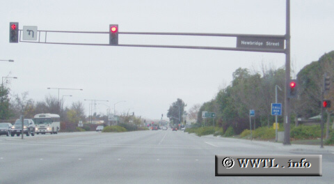
(Eastbound Willow Road; Menlo Park, California)
--Photo taken by Dan Peri c. 2000s ✔
Map Location: 37.47279, -122.15446![]()
State Route 114 at Newbridge Street. Strangely, the blue call-boxes do not reference State Route 114; instead, they indicate the "route-number" as `MP` (Menlo Park).
Next photo>>>
<<<Previous
photo
Distance Chart for
California 114
California 114
| Dumbarton Bridge | |||||
| 1.8 | Junction California 84 | ||||
| 1.4 | 3.2 | Junction Federal Route 101 | |||
Approximate distance in km
(1 km = 0.621 miles)
(1 km = 0.621 miles)