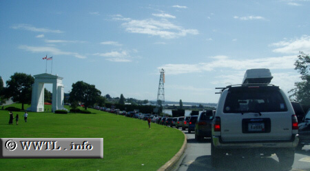
(Southbound Route 99 Freeway; approaching US-Canada border)
--Photo taken by Dan Peri c. 2000s ✔
Viatype:S4-D
Map Location: 49.00225, -122.75719![]()
English | français
Route 99 ends at the International Peace Arch (the white monument to the left). Once passing the arch, Interstate 5 and the United States begin.
Distance Chart for
British Columbia 99
British Columbia 99
| Lillooet | |||||||||
| 100 | Pemberton | ||||||||
| 189 | 91 | Squamish | |||||||
| 252 | 153 | 64 | Vancouver | ||||||
| 131 | 33 | 59 | 121 | Whistler | |||||
Approximate distance in km
(1 km = 0.621 miles)
(1 km = 0.621 miles)