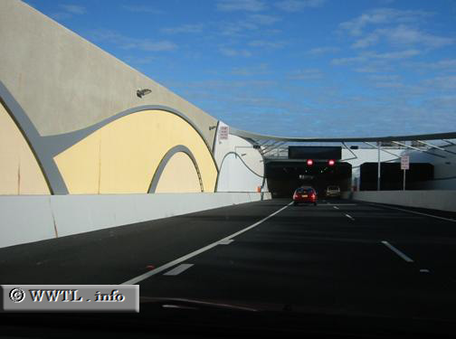
(Northbound M1 [National Route 1]; Tweed Heads, New South Wales)
--Photo taken by Vishwarma Hindrabagi c. 2000s ✔
Viatype:S1-U
Map Location: -28.17781, 153.51487![]()
This bypass serves 40,000 to 50,000 motorists per day. That number is
expected to dramatically increase by 2017, when Gold Coast tourists will, by
default, perceive this highway as the primary conduit between northern New South Wales and
southern Queensland.
Next
photo>>>
<<<Previous photo
Distance Chart for
Australia National Route 1
Australia National Route 1
| Adelaide, South Australia | |||||||||
| 2804 | Brisbane, Queensland | ||||||||
| 3220 | 6994 | Darwin, Northern Territory | |||||||
| 6024 | 4216 | 4150 | Perth, W. Australia | ||||||
| 1887 | 917 | 5133 | 5107 | Sydney | |||||
Approximate distance in km
(1 km = 0.621 miles)
(1 km = 0.621 miles)