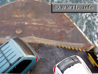
(Eastbound State Route 20; Admiralty Inlet, Washington State)
--Photo taken by Dan Peri c. 2000s ✔
Viatype:S2-U
Map Location: 48.110956, -122.757218![]()
How ironic -- this stretch of eastbound Washington State Route 20 moves the cars. Yet, the cars remain stationary :-)
Next photo>>>
<<<Previous photo
Distance Chart for
State Route 20
State Route 20
| Burlington | |||||||||
| 74 | Concrete | ||||||||
| 159 | 95 | Junction Federal Rte 101 | |||||||
| 109 | 35 | 60 | Newport | ||||||
| 176 | 102 | 67 | 7 | Fall River/Tomasket | |||||
Approximate distance in km
(1 km = 0.621 miles)
(1 km = 0.621 miles)