(End of Interstate 5, @ US-México border)
--Photo taken by Carlos Rogers c. 2000s ✔
Viatype:S4-D
Map Location: 32.54279, -117.03067![]()
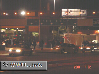
Vehicle traffic was surprisingly light at Interstate 5's connection w/ México Route
1D. This picture was taken during mid-week, which may explain the
less-than-expected backup.
Distance Chart for
San Ysidro Border Crossing
San Ysidro Border Crossing
| San Ysidro District, San Diego, California | |||
| 0 | Tijuana, Baja California | ||
Approximate distance in km
(1 km = 0.621 miles)
(1 km = 0.621 miles)