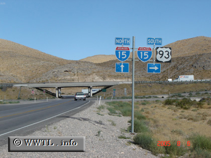
(Southbound US Federal Route 93; Clark County, Nevada)
--Photo taken by Carlos Rogers in 2005 ✔
Viatype:F4-D
Map Location: 36.38624, -114.89219![]()
Junction Interstate 15. Check out the next picture for something really amazing.
<<<Previous photo
Distance Chart for
Federal Route 93
Federal Route 93
| Eureka, Montana | |||||||||
| 1971 | Las Vegas | ||||||||
| 481 | 1451 | Missoula, Montana | |||||||
| 1103 | 868 | 622 | Twin Falls, Idaho | ||||||
| 2345 | 374 | 1864 | 1242 | Wickenburg, Arizona | |||||
Approximate distance in km
(1 km = 0.621 miles)
(1 km = 0.621 miles)