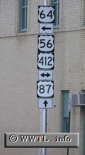
(Southbound Federal Route 87/Eastbound Federal Route 64; Clayton, New México)
--Photo taken by Chris Elbert in 2004 ✔
Map Location: 36.45189, -103.18447![]()
Federal Route 87, a major carrier of traffic in the American Rockies and south-central plains, has much of its pathway obscured by the presence of Interstate 25. For that Interstate (almost entirely) overlays the Federal Route's path in Colorado, the CO Department of Transportation generally omits Federal Route 87 signage altogether.
Distance Chart for
Federal Route 87
Federal Route 87
| Cheyenne, Wyoming | |||||||||
| 166 | Denver, Colorado | ||||||||
| 1270 | 1430 | Havre, Montana | |||||||
| 1946 | 1779 | 3215 | Port Lavaca, Texas | ||||||
| 1717 | 1551 | 2987 | 228 | San Antonio, Texas | |||||
Approximate distance in km
(1 km = 0.621 miles)
(1 km = 0.621 miles)