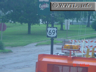
(Northbound US Federal Route 69; Osceola, Iowa)
--Photo taken by Carlos Rogers c. 2000s ✔
Viatype:S2-U
Map Location: 41.03712, -93.76562![]()
Sexual innuendo?
Distance Chart for
Federal Route 69
Federal Route 69
| Albert Lea, Minnesota | |||||||||
| 257 | Des Moines, Iowa | ||||||||
| 592 | 335 | Kansas City, Missouri | |||||||
| 1100 | 763 | 428 | Muskogee, Oklahoma | ||||||
| 1828 | 1571 | 1236 | 808 | Fort Arthur, Texas | |||||
Approximate distance in km
(1 km = 0.621 miles)
(1 km = 0.621 miles)