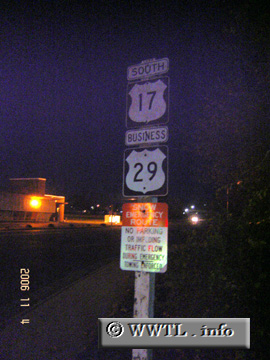
(Southbound W. Shirley Avenue; Warrenton, Virginia)
--Photo taken by Carlos Rogers in 2006 ✔
Viatype:S4-D
Map Location: 38.71657, -77.80823
US Federal Route 17 spans from northern Virginia to Florida. In the American Southeast, it enjoys a routing along the Atlantic Ocean.
Distance Chart for
Federal Route 17
Federal Route 17
| Jacksonville, Florida | |||||||||
| 1124 | Norfolk, Virginia | ||||||||
| 1597 | 463 | Punta Gorda, Florida | |||||||
| 1537 | 813 | 241 | Savannah, Georgia | ||||||
| 1454 | 330 | 1917 | 704 | Winchester, Virginia | |||||
Approximate distance in km
(1 km = 0.621 miles)
(1 km = 0.621 miles)