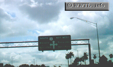
(Southbound US Federal Route 1; Miami-Dade County, Florida)
--Photo taken by Shelina Chandra c. 2000s ✔
Viatype:S6-D
Map Location: 25.44953, -80.47521
Federal Route 1 is one of the East Coast's major surface-street drags, spanning from the Florida Keys to New Brunswick, Canada.
Distance Chart for
Federal Route 1
Federal Route 1
| Boston | |||||||||
| 2707 | Miami | ||||||||
| 403 | 2304 | New York | |||||||
| 664 | 2143 | 161 | Philadelphia | ||||||
| 790 | 1917 | 387 | 226 | Washington, D.C. | |||||
Approximate distance in km
(1 km = 0.621 miles)
(1 km = 0.621 miles)