| |
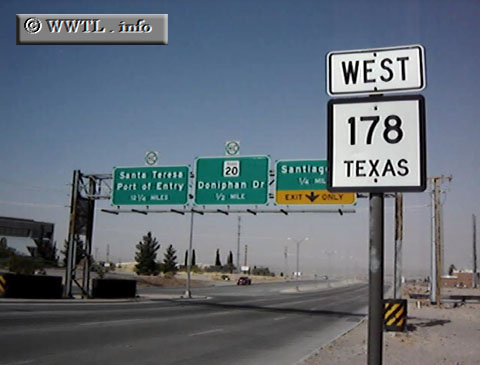
(Westbound Artcraft Road; El Paso, Texas)
--Photo taken by Carlos Rogers c. 2000s ✔
Viatype:F4-D
Map Location: 31.88087, -106.59054
Highway 178 helps funnel
motorists from Interstate 10 to southeastern New Mexico. West of the
border, New Mexico State Route 136 takes over and allows a connection to México
via the Santa Teresa border crossing.
|
Distance Chart for
Texas 178 | Junction Interstate 10 | | 8 | | Santa Teresa, New Mexico |
Approximate distance in km
(1 km = 0.621 miles)
|