| | 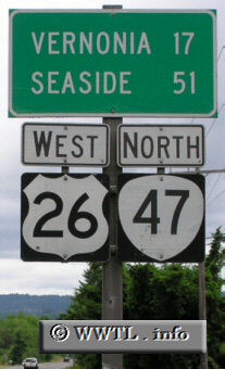
(Northbound State Route 47/Westbound Federal Route 26; Polk County, Oregon)
--Photo taken by Chris Elbert c. 2000s ✔
Viatype:S2-U
Map Location: 45.645435, -123.13656
Route 47 connects Clatskanie with Lafayette. In north-central Washington
County, the route forms a four-mile duplex with Federal Route 26.
| |