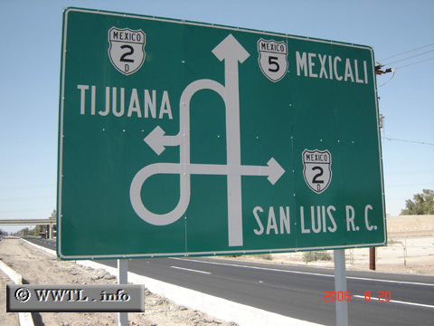
(Northbound Federal Route 5; Mexicali municipality, Baja California)
--Photo taken by Carlos Rogers in 2006 ✔
Viatype:F4-D
Map Location: 32.5324, -115.40909
English | español
Imagine driving on northbound Federal Route 5 for hours. Your average travel speed is 100 km/h and you're getting awful thirsty. You then wish to find westbound Federal Route 2 and and head towards Tecate. In the blink of an eye, would this diagram come off a little confusing ? :-)