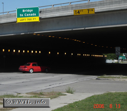
(Northbound Pine Grove Avenue; Port Huron, Michigan)
--Photo taken by Carlos Rogers in 2006 ✔
Viatype:F4-D
Map Location: 42.99803, -82.43633![]()
The duplex terminates just shy of the Canadian border.
Distance Chart for
Interstate Business Rte. 69
Interstate Business Rte. 69
| Blue Water Bridge, USA-Canada | |||||
| 5.6 | Port Huron, Michigan | ||||
| 14 | 8.2 | Port Huron Township, Michigan | |||
Approximate distance in km
(1 km = 0.621 miles)
(1 km = 0.621 miles)