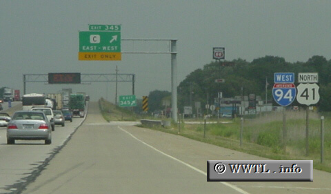
(Westbound Interstate 94/Federal Route 41.; Pleasant Prairie, Wisconsin)
--Photo taken by Carlos Rogers in 2006 ✔
Viatype:F6-D
Map Location: 42.5378, -87.95234![]()
Interstate 94 and US 41 share the same stretch of pavement going north from the IL-WI state line. This duplex spans ~42 miles.
Next photo>>>
<<<Previous
photo
Distance Chart for
USA Interstate 94
USA Interstate 94
| Billings, Montana | |||||||||
| 2031 | Chicago | ||||||||
| 2494 | 463 | Detroit | |||||||
| 1891 | 148 | 611 | Milwaukee, Wisconsin | ||||||
| 1349 | 691 | 1164 | 543 | Minneapolis | |||||
Approximate distance in km
(1 km = 0.621 miles)
(1 km = 0.621 miles)