| | 
(Eastbound Interstate 794; Milwaukee, Wisconsin)
--Photo taken by Carlos Rogers c. 2000s ✔
Viatype:F8-D
Map Location: 43.0355, -87.90808
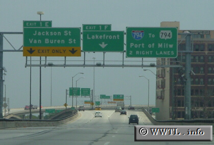
Interstate 794 serves downtown
Milwaukee, and the General Mitchell Int'l Airport. Exit 1F, as shown in
the above picture, is the unsigned beginning of westbound Federal Route 18.
| |