In western Colorado, the canyons accompanying the Colorado River are narrow
and steep. As a result, each travel-direction of Interstate 70 has a different
elevation tier.
<<<Previous photo
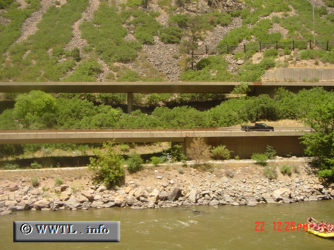
(Eastbound Interstate 70; Glenwood Springs, Colorado)
--Photo taken by Carlos Rogers in 2001 ✔
Viatype:F4-D
Map Location: 39.55132, -107.31878![]()
![]()
![]()
![]()
![]()
Distance Chart for
USA Interstate 70
USA Interstate 70
| Baltimore | |||||||||
| 3497 | Cove Fort, Utah | ||||||||
| 2687 | 812 | Denver | |||||||
| 944 | 1747 | 2563 | Indianapolis | ||||||
| 1334 | 1390 | 2176 | 1370 | St Louis, Missouri | |||||
Approximate distance in km
(1 km = 0.621 miles)
(1 km = 0.621 miles)