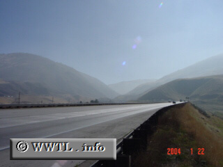
(Southbound Golden State Freeway; Grapevine, California)
--Photo taken by Carlos Rogers c. 2000s ✔
Viatype:F8-D
Map Location: 34.92841, -118.92893![]() Before southbound Interstate 5 enters Los Angeles, one
must travel through the Grapevine. This region has rapid increases in
elevation, beginning near sea-level to its summit of 4,000 ft (at Tejon Pass).
Before southbound Interstate 5 enters Los Angeles, one
must travel through the Grapevine. This region has rapid increases in
elevation, beginning near sea-level to its summit of 4,000 ft (at Tejon Pass).
Next
photo>>>
<<<Previous photo
Distance Chart for
USA Interstate 5
USA Interstate 5
| Los Angeles | |||||||||
| 1550 | Portland, Oregon | ||||||||
| 194 | 1742 | San Diego, California | |||||||
| 618 | 932 | 810 | Sacramento, California | ||||||
| 1826 | 281 | 2020 | 1210 | Seattle | |||||
Approximate distance in km
(1 km = 0.621 miles)
(1 km = 0.621 miles)