| |
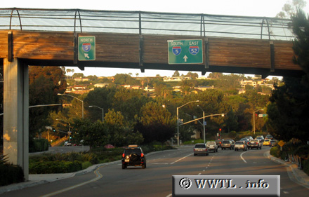 (Eastbound Torrey Pines Road; La Jolla
district, San Diego, California)
(Eastbound Torrey Pines Road; La Jolla
district, San Diego, California)
--Photo taken by Carlos Rogers in 2009 ✔
Viatype:F4-D
Map Location:
32.85043, -117.25356
Viatype:S4-D
An "Interstate 52" shield is posted here in La Jolla. In reality, this road leads motorists towards State Route 52.
Next
photo>>>
|
Distance Chart for
California 52 | Junction Interstate 5 | | 12 | | Junction Interstate 15 | | 22 | | 14 | | La Jolla, San Diego | | 24 | | 12 | | 26 | | Santee |
Approximate distance in km
(1 km = 0.621 miles)
|