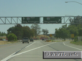
(End of Southbound Interstate 505; Vacaville, California)
--Photo taken by Carlos Rogers c. 2000s ✔
Viatype:F4-D
Map Location: 38.3744, -121.95451
At the southern end of Interstate 505, a motorist has the choice of Interstate 80 East or West. The eastbound ramp is a flyover ramp, while the westbound is a short merge.
Distance Chart for
Interstate 505
Interstate 505
| Dunnigan, California | |||||
| 63 | Vacaville, California | ||||
| 20 | 43 | Winters, California | |||
Approximate distance in km
(1 km = 0.621 miles)
(1 km = 0.621 miles)