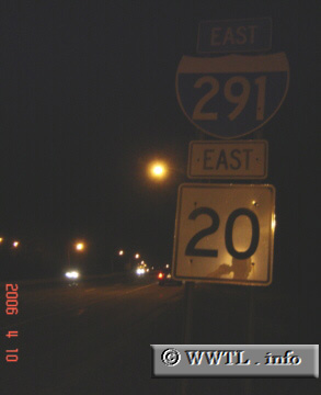
(Eastbound Interstate 291/Eastbound Federal Route 20; Springfield, Massachusetts)
--Photo taken by Carlos Rogers c. 2000s ✔
Viatype:F4-D
Map Location: 42.11994, -72.5798![]()
Interstate 291 (Massachusetts) cuts through
Springfield, connecting Interstate 91 with the Interstate 90 tollway. Interestingly, the
route's northern-terminus is not at Interstate 90; instead, it ends arbitrarily
at a set of stop-lights which provide entrance-ramps to Interstate 90. The entire
length of Interstate 290 concurs with a duplex of Federal Route 20.
Interestingly above, the shield-assembly refers to Federal Route 20 instead of an
"MA-20" marker.
| Distance Chart for Interstate 291
Approximate distance in km (1 km = 0.621 miles) | ||||||||