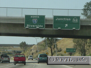
(Northbound Escondido Freeway at Route 52; San Diego, California)
--Photo taken by Carlos Rogers in 2005 ✔
Viatype:F8-D
Map Location: 32.83360, -117.11868![]()
Interstate 15 is the longest north/south Interstate in the Western United States. It connects San Diego, CA with the Montana/Alberta (Canada) border crossing. Future plans call for Interstate 15 to connect with the San Diego Harbor, about 6 miles south of its current southern terminus.
Jump to: Nevada | Arizona | Utah
Distance Chart for
Interstate 15
Interstate 15
| Helena, Montana | |||||||||||
| 1452 | Las Vegas | ||||||||||
| 517 | 937 | Pocatello, Idaho | |||||||||
| 778 | 677 | 264 | Salt Lake City, Utah | ||||||||
| 1982 | 536 | 1476 | 1216 | San Diego, Calif. | |||||||
Approximate distance in km
(1 km = 0.621 miles)
(1 km = 0.621 miles)