(Eastbound Santa Monica Freeway; Santa Monica,
California)
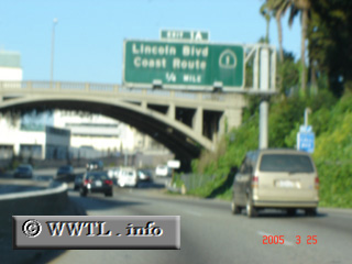
--Photo taken by Carlos Rogers in 2005 ✔
Viatype:F8-D
Map Location: 34.0118, -118.4934![]()
Exit 1A, the Pacific Coast Highway. For some unknown reason, I experienced a short-lapse of anxiety during this photograph, compromising its quality. A possible explanation is the anticipation of reaching this junction, a moment I've been planning since early childhood.
Next photo>>>
<<<Previous
photo
Distance Chart for
USA Interstate 10
USA Interstate 10
| El Paso | |||||||||
| 1099 | Houston | ||||||||
| 2636 | 1437 | Jacksonville, Florida | |||||||
| 1291 | 2490 | 3925 | Los Angeles | ||||||
| 692 | 1892 | 3327 | 600 | Phoenix | |||||
Approximate distance in km
(1 km = 0.621 miles)
(1 km = 0.621 miles)