(Westbound former Federal Route 66; Cherokee County, Kansas)
--Photo taken by Ernst Marti c. 2000s ✔
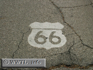
When Route 66 was alive and kicking, it had the shortest of paths in Kansas. Only eleven miles! Could you imagine the competition between local service-stations and agriculture stands? Oh nelly. |
Next
photo>>>
<<<Previous
photo
Distance Chart for
Historic Route 66
Historic Route 66
| Albuquerque, New Mexico | |||||||||
| 2158 | Chicago | ||||||||
| 515 | 2673 | Flagstaff, Arizona | |||||||
| 871 | 1287 | 1386 | Oklahoma City | ||||||
| 1508 | 3666 | 993 | 2381 | Santa Monica | |||||
Approximate distance in km
(1 km = 0.621 miles)
(1 km = 0.621 miles)