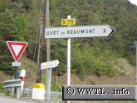
France
(Junction D70; Isère)
--Photo taken by Carlos Rogers in 2005
✔
Viatype:
S2-U
Map Location:
44.84034, 5.87602
English |
français
Highway D70 provides access to Quet-en-Beaumont and the Drac River.
Next photo>>>
Bookmark with:
Share information about this road!
Distance Chart for
Isère Route D70
Junction National Route 85
0.1
Haut-Quet, Quet-en-Beaumont
1.8
1.7
Quet-en-Beaumont, Isère
Approximate distance in km
(1 km = 0.621 miles)